Skip to product information
1 of 7

GARMIN

Garmin eTrex 32x – Rugged Handheld GPS with Compass and Barometric Altimeter – 010-02257-00

Garmin eTrex 32x – Rugged Handheld GPS with Compass and Barometric Altimeter – 010-02257-00

SKU:010-02257-00

Regular price $299.99
Regular price Sale price $299.99
Sale

FREE SHIPPING on orders $100+

Large freight items excluded. View Shipping Policy

View full details

Garmin · Handhelds

Rugged handheld navigation with sensors and TopoActive

The Garmin eTrex® 32x (Rugged Handheld GPS with Compass and Barometric Altimeter) is a compact, go-anywhere handheld GPS device built for outdoor navigation and trip tracking. It pairs a sunlight-readable 2.2" transflective, 65K color TFT display with preloaded routable TopoActive maps to help guide hikes, hunts, or backcountry exploring.

Designed to handle the elements, it carries an IPX7 water rating and runs on 2 AA batteries (not included) for up to 25 hours. With 8 GB of memory and support for adding maps via microSD card, it’s set up for building a detailed library of waypoints, routes, and saved tracks over time.

  • Part Number010-02257-00
  • Display Type2.2" transflective, 65K color TFT
  • Battery life25 hours
  • Water ratingIPX7
  • Weight5 oz (141.7 g) with batteries

Preloaded routable topo maps

eTrex® 32x includes preloaded TopoActive maps that are routable. Mapping details include hydrographic features, searchable points of interest such as parks and campgrounds, and displayed national, state and local parks, forests and wilderness areas for confident route planning in the field.

Garmin eTrex 32x – Rugged Handheld GPS with Compass and Barometric Altimeter – Preloaded routable topo maps

3-axis compass and altimeter

For better orientation off-trail, this handheld includes a tilt-compensated 3-axis compass plus a barometric altimeter. It also supports GPS and GLONASS with a high-sensitivity receiver, and provides a GPS compass while moving to help keep direction and elevation context clear.

Garmin eTrex 32x – Rugged Handheld GPS with Compass and Barometric Altimeter – 3-axis compass and altimeter

Track, route, and waypoint storage

Built for repeat adventures, it can store 2000 waypoints, 200 routes, and 200 tracks. The navigation track log supports 10000 points and 200 saved tracks, making it easy to review where the trip went and reuse favorite routes later.

Garmin eTrex 32x – Rugged Handheld GPS with Compass and Barometric Altimeter – Track, route, and waypoint storage
Garmin eTrex 32x – Rugged Handheld GPS with Compass and Barometric Altimeter – Built for the outdoors

Durability

Built for the outdoors

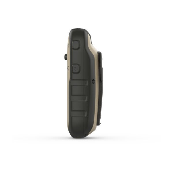
The eTrex® 32x is sized for easy carry at 2.1" x 4.0" x 1.3" (5.4 x 10.3 x 3.3 cm) and weighs 5 oz (141.7 g) with batteries. An acrylic lens and IPX7 water rating support use in wet, dusty, and unpredictable conditions. The 2.2" display delivers 240 x 320 pixels of mapping and data, and the unit connects through a mini USB interface for simple wired connection needs.

Garmin eTrex 32x – Rugged Handheld GPS with Compass and Barometric Altimeter – Expandable mapping and memory

Navigation

Expandable mapping and memory

Alongside its 8 GB of internal memory, eTrex® 32x supports adding maps via microSD card with external memory storage up to a 32 GB max microSD™ card. It supports up to 3000 map segments, enabling larger map libraries for travel and exploration. Custom maps compatibility is included, with support for 100 custom map tiles to tailor coverage to specific riding, hiking, or scouting areas.

Garmin eTrex 32x – Rugged Handheld GPS with Compass and Barometric Altimeter – Outdoor tools and connections

Connectivity

Outdoor tools and connections

Beyond navigation, eTrex® 32x includes practical outdoor features such as area calculation, sun and moon information, a fish forecast, and a picture viewer. It’s also geocaching-friendly with paperless support. For wireless accessories and compatible functions, it offers wireless connectivity via ANT+® and includes VIRB® Remote support.

Specifications

Part Number 010-02257-00
Model eTrex® 32x
Configuration Rugged Handheld GPS with Compass and Barometric Altimeter
Lens material Acrylic
Dimension 2.1" x 4.0" x 1.3" (5.4 x 10.3 x 3.3 cm)
Weight 5 oz (141.7 g) with batteries
Water rating IPX7
Display Type 2.2" transflective, 65K color TFT
Display Size 1.4" x 1.7" (3.5 x 4.4 cm); 2.2" diag (5.6 cm)
Display resolution 240 x 320 pixels
Battery Type 2 AA batteries (not included); NiMH or Lithium recommended
Battery life 25 hours
Memory/History 8 GB
Interface Mini USB

In the Box

eTrex 32x
USB cable
Documentation

Features at a Glance

Maps & Memory Basemap, Automatic routing (turn by turn routing on roads) for outdoor activities, Includes detailed hydrographic features (coastlines, lake/river shorelines, wetlands and perennial and seasonal streams), Includes searchable points of interests (parks, campgrounds, scenic lookouts and picnic sites), Displays national, state and local parks, forests and wilderness areas
Sensors GPS, GLONASS, Barometric altimeter, High-sensitivity receiver, GPS compass (while moving)
Daily Smart Features VIRB® Remote
Outdoor Recreation Area calculation, Fish forecast, Sun and moon information, Picture viewer
Mapping & Navigation Point-to-point navigation

Additional Specifications

Maps & Memory
Preloaded maps Yes (TopoActive; routable)
Ability to add maps Yes (via microSD card)
Map segments 3000
External memory storage Yes (32 GB max microSD™ card)
Waypoints/favorites/locations 2000
Tracks 200
Navigation Track Log 10000 points, 200 saved tracks
Navigation Routes 200 routes, 250 points per route; 50 points auto routing
Outdoor Recreation
Geocaching-friendly Yes (Paperless)
Custom maps compatible Yes (100 custom map tiles)
⚠️ WARNING: This product can expose you to chemicals including lead and phthalates, which are known to the State of California to cause cancer and birth defects or other reproductive harm. Learn more.