Skip to product information
1 of 10

GARMIN

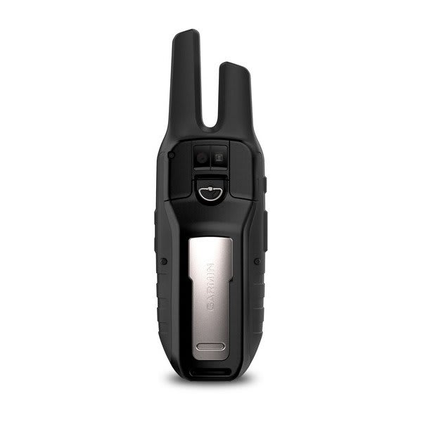
Garmin Rino 755t – 2-Way Radio/GPS Navigator with Touchscreen, TOPO Mapping and Camera – 010-01958-15

Garmin Rino 755t – 2-Way Radio/GPS Navigator with Touchscreen, TOPO Mapping and Camera – 010-01958-15

SKU:010-01958-15

Regular price $649.99
Regular price Sale price $649.99
Sale

FREE SHIPPING on orders $100+

Large freight items excluded. View Shipping Policy

View full details

Garmin · Handhelds

Touchscreen GPS and GMRS Radio in One

The Garmin Rino® 755t 2-Way Radio/GPS Navigator with Touchscreen, TOPO Mapping and Camera combines handheld navigation and GMRS two-way communication in a single rugged device. It’s built for outdoor users who want to track position, manage routes and waypoints, and stay in touch with a compatible GMRS radio network while traveling beyond cell service.

This configuration features a 3.0" transflective, 65K color TFT touchscreen display, preloaded TOPO U.S. 100K mapping, and an integrated 8 megapixel camera with autofocus and automatic geo-tagging. With support for GPS and GLONASS, a tilt-compensated 3-axis compass, and expandable storage via microSD™ card, it’s designed to help keep navigation and communication organized on the same screen.

  • Part Number010-01958-15
  • Display Type3.0" transflective, 65K color TFT
  • Water ratingIPX7
  • Weight12.3 oz (348 g) with battery pack
  • Dimension2.6” x 7.9” x 1.6” (6.6 x 20.1 x 4.1 cm)

GMRS radio communication

Integrated GMRS radio capability supports 22 channels, VOX (voice activation), vibration alerts, and NOAA weather radio. Location reporting lets users send and receive GPS positions, and the device stores up to 50 contacts with 2000 track points each. Range is rated up to 20 miles over GMRS.

Garmin Rino 755t – 2-Way Radio/GPS Navigator with Touchscreen, TOPO Mapping and Camera – GMRS radio communication

Touchscreen topo navigation

The 3.0" transflective touchscreen is paired with preloaded TOPO U.S. 100K maps (not routable) and support for adding maps via microSD™ card up to 32 GB. It can store 10000 waypoints, 250 routes, and extensive track logging for keeping trips documented and repeatable.

Garmin Rino 755t – 2-Way Radio/GPS Navigator with Touchscreen, TOPO Mapping and Camera – Touchscreen topo navigation

Geotagged photos on the trail

An 8 megapixel camera with autofocus captures field photos with automatic geo-tagging to help tie images to specific locations. A built-in picture viewer makes it easy to review shots on the device, and 4x digital zoom helps frame subjects when documenting waypoints, camps, or landmarks.

Garmin Rino 755t – 2-Way Radio/GPS Navigator with Touchscreen, TOPO Mapping and Camera – Geotagged photos on the trail
Garmin Rino 755t – 2-Way Radio/GPS Navigator with Touchscreen, TOPO Mapping and Camera – Built for outdoor positioning

Built for outdoor positioning

Rino® 755t supports GPS and GLONASS with a high-sensitivity receiver, and adds a barometric altimeter plus a tilt-compensated 3-axis compass. The unit also provides a GPS compass while moving, supporting point-to-point navigation and helping maintain situational awareness when traveling through varied terrain.

Garmin Rino 755t – 2-Way Radio/GPS Navigator with Touchscreen, TOPO Mapping and Camera – Storage for bigger adventures

Storage for bigger adventures

With 4.5 GB of memory (user space varies based on included mapping) plus external storage support for a 32 GB max microSD™ card, the device is designed to handle large trip libraries. It supports up to 15000 map segments, 20000 points in the navigation track log with 200 saved tracks, and up to 10000 waypoints.

Garmin Rino 755t – 2-Way Radio/GPS Navigator with Touchscreen, TOPO Mapping and Camera – Smart features when paired

Smart features when paired

When used with compatible connections, Rino® 755t supports Bluetooth® and ANT+® wireless connectivity along with smart notifications on handheld. It also pairs with Garmin Connect™ mobile and supports LiveTrack, weather and weather forecasts, VIRB® Remote, and Connect IQ™ downloadable watch faces, data fields and apps.

Specifications

Part Number 010-01958-15
Model Rino® 755t
Configuration 2-Way Radio/GPS Navigator with Touchscreen, TOPO Mapping and Camera
Lens material Chemically strengthened glass
Dimension 2.6” x 7.9” x 1.6” (6.6 x 20.1 x 4.1 cm)
Weight 12.3 oz (348 g) with battery pack
Water rating IPX7
Display Type 3.0" transflective, 65K color TFT
Display Size 1.53” x 2.55” (3.8 x 6.4 cm); 3.0" diag (7.6 cm)
Display resolution 240 x 400 pixels
Battery Type Removable, rechargeable lithium-ion battery pack; AA battery pack (not included)
Battery life Up to 14 hours (up to 18 hours with optional AA battery pack at 2 watts)
Memory/History 4.5 GB (user space varies based on included mapping)
Interface High speed mini USB and NMEA 0183 compatible

In the Box

Rino 755t
Preloaded TOPO U.S. 100K maps
Lithium-ion battery pack
USB cable
AC charger
Carabiner clip
Documentation

Features at a Glance

General Touchscreen
Maps & Memory Ability to add maps, Basemap, Includes detailed hydrographic features (coastlines, lake/river shorelines, wetlands and perennial and seasonal streams), Includes searchable points of interests (parks, campgrounds, scenic lookouts and picnic sites), Displays national, state and local parks, forests and wilderness areas
Sensors GPS, GLONASS, Barometric altimeter, High-sensitivity receiver, GPS compass (while moving)
Daily Smart Features Connect IQ™ (downloadable watch faces, data fields and apps), Smart notifications on handheld, Weather forecasts, Weather, VIRB® Remote, Pairs with Garmin Connect™ mobile
Safety and Tracking Features LiveTrack
Tactical Features XERO™ Locations
Outdoor Recreation Area calculation, Fish forecast, Sun and moon information, Picture viewer, LED beacon flashlight
Mapping & Navigation Point-to-point navigation
Radio Features VOX (voice activation), Location reporting (send and receive GPS positions), Vibration alert, NOAA weather radio

Additional Specifications

Maps & Memory
Preloaded maps Yes (TOPO U.S. 100K; not routable)
Automatic routing (turn by turn routing on roads) for outdoor activities Yes (with optional mapping for detailed roads)
Map segments 15000
External memory storage Yes (32 GB max microSD™ card)
Waypoints/favorites/locations 10000
Tracks 250
Navigation Track Log 20000 points, 200 saved tracks
Navigation Routes 250, 250 points per route; 50 points auto routing
Outdoor Recreation
Geocaching-friendly Yes (Geocache Live)
Custom maps compatible Yes (500 custom map tiles)
Camera Yes (8 megapixel with autofocus; 4x digital zoom; automatic geo-tagging)
Radio Features
Frequency band GMRS
Channels 22
Squelch codes 38 (CTCSS); 83 (DCS)
Range Up to 20 miles over GMRS
Contacts 50 contacts with 2000 track points each
⚠️ WARNING: This product can expose you to chemicals including lead and phthalates, which are known to the State of California to cause cancer and birth defects or other reproductive harm. Learn more.